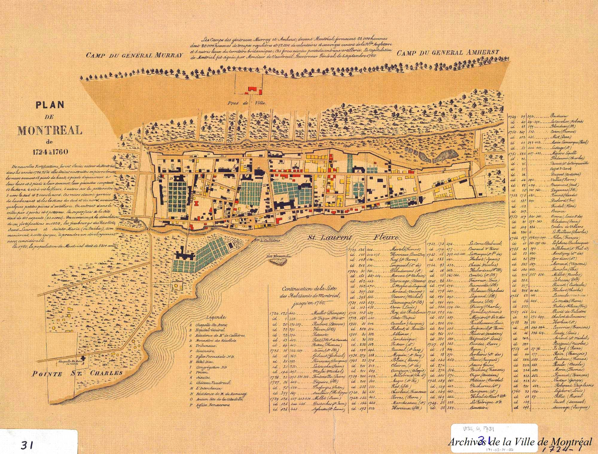
Something is wrong with this map. My ancestor André Marcille bought a property on St. Paul Street in 1723. In 1725 he had a house built there. He rented it out from 1729 to at least 1738. He died in 1740 and in 1748 his widow and children sold it to Vincent Moran, Master Tailor. Moran still owned it when he died (in 1761, I think) and eventually, in 1768, his daughter Veronique sold it to Reverend Deslile. I have all of the deeds (« actes des notaires ») and those dates and names are certain. Every acte described the property as being on the south side of St. Paul Street and extending to the fortifications. I looked at this map with great interest, since I wanted to learn the exact location of the land. But if I understand this map correctly, it shows Moran as acquiring no land before 1755, and in 1755 acquiring land on the north side of the street. All wrong. A great disappointment! Who created this map, and on what basis??
This collection of plans was published in 1884 by Honoré Beaugrand, editor of La Patrie (and mayor of Montreal from 1885 to 1887). It is quite possible that mistakes were made at the time…. The complete document can be found in our catalogue here: https://archivesdemontreal.ica-atom.org/1611-2-le-vieux-montreal-1611-1803-1884